| MTB Home | BikeCal.com Home | | ||
|
|
||||||||||||||||||||||||||
![[A picture of Sugarloaf Ridge State Park]](images/sugarloaf2.jpg) Sugarloaf
Ridge State Park
Sugarloaf
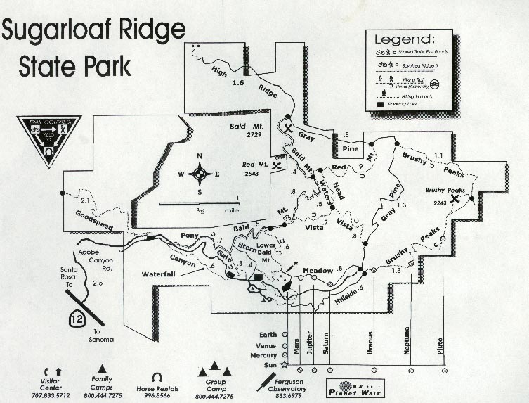
Ridge State Park This 2,700 acre park contains 21 miles of trails. Elevation ranges from 600 to 2,729 feet above sea level.
How to Get There:
To get to the park from Santa Rosa take Hwy 101 to Hwy 12 and go east for 11 miles. Turn left on Adobe Canyon Road. Continue north into the park. There is a day use fee per vehicle if you drive into the park. But there is a small parking area on the left just before the entrance, and you can park there and ride in without paying a fee.The Ride:
This is a 6 1/2 mile loop that follows the Stern, Bald Mountain, and Gray Pine trails. This leads you on a steep 2 3/4 mile climb to the summit of Bald Mountain at 2729 feet (total elevation change is 1630 feet). Most of the climb is on a paved fire road. From the summit you travel 3 3/4 miles back down to the trailhead.Sonoma County Parks - Sugar Loaf Ridge State Park Sonic Net, Inc.
Parks and Recreation in Sonoma County - Sugarloaf Ridge State Park
© Bikecal.com 2006 |