Cotati to Tomales
Tomales Bakery Ride
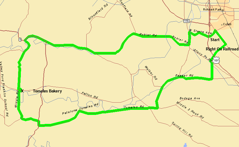
Click for an enlargement - to print the map, click on it and then print the next screen
Route
Start in downtown Cotati - south on Old Redwood Highway - R on West Railroad - L on Stony Point - R on Jewett - R on Pepper - R on Petaluma/Valley Ford - L on Petaluma/Tomales - R on Hwy 1 to the Tomales Bakery (rest stop) - Dillon Beach Rd - R on Middle - R on Hwy 1 - L on Petaluma/Valley Ford - L on Roblar - L on Stony Point - R on West Sierra to the end at Cotati Park.
Distance: 37 Miles
Elevation: 1420'
Rating: Easy, some hills